Ningalku Map Illa- The Maphunt
Table of contents:
നിങ്ങൾക്ക്മാപ്പ്ഇല്ല (Read as Ningalku Map Illa) is the hashtag I started on social media for flagging wrong maps of Kerala. This is the expanded form of my Twitter thread which features wrong maps of Kerala by various organisations.
License: This article is licensed under the Creative Commons Attribution-ShareAlike 4.0 International (CC BY-SA 4.0) license.
Recently social media was yelling about the usage of the wrong map of India by Twitter on their website. Well before the issue, I had started a hashtag campaign on the wrong maps published by the government and various other reputed organisations. The Hashtag was only limited to the Kerala Maps. Some people had put some effort in correcting the maps some might not have seen, some have ignored.
The goal of this campaign is not the blame or defame anyone, but to correct and educate everyone on the matter of maps. Hence as a geospatial person, I feel this is my duty to point out the mistakes and help people in correcting them.
Hashtag - #നിങ്ങൾക്ക്മാപ്പ്ഇല്ല
Though I started the thread without a hashtag thing there won’t be a big number, soon I realised that all I saw was the tip of the iceberg. Hence going with the suggestion put forward by Jasbeer, my friend I adopted the hashtag #നിങ്ങൾക്ക്മാപ്പ്ഇല്ല.
The hashtag means നിങ്ങൾക്ക് മാപ്പ് (മാപ്പ് = Map) ഇല്ല - You lack maps. It also has a Homonym meaning നിങ്ങൾക്ക് മാപ്പ് (മാപ്പ് = Pardon) ഇല്ല. It’s unforgivable.
The Common mistake
Most of the wrong maps were having the same mistake. So thought of sharing the reason with you all to be conscious on maps hereafter. Let me confess, I have also used the wrong map long back, and corrected it after knowing. Surprisingly the map we are using is 23 years old.
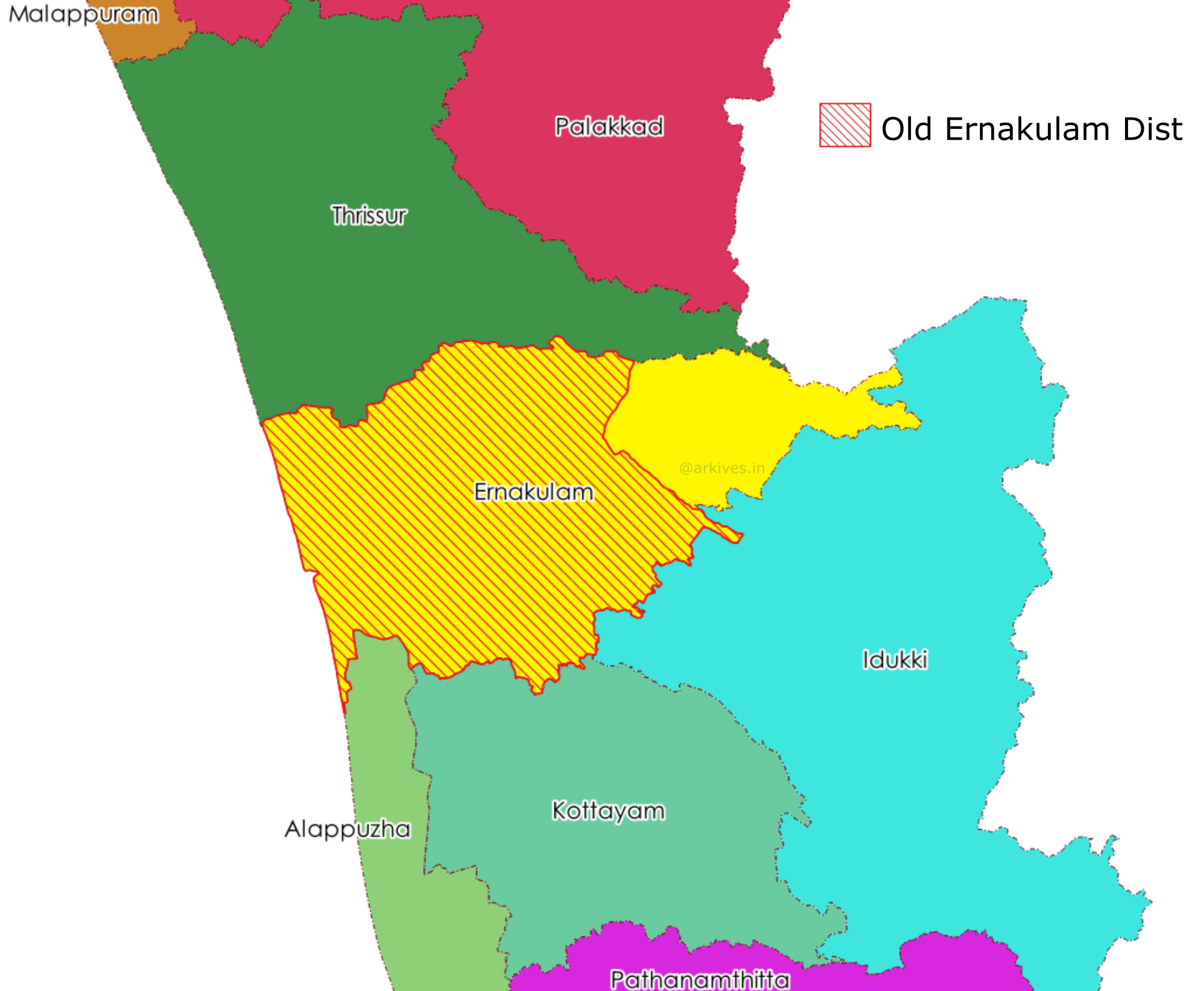
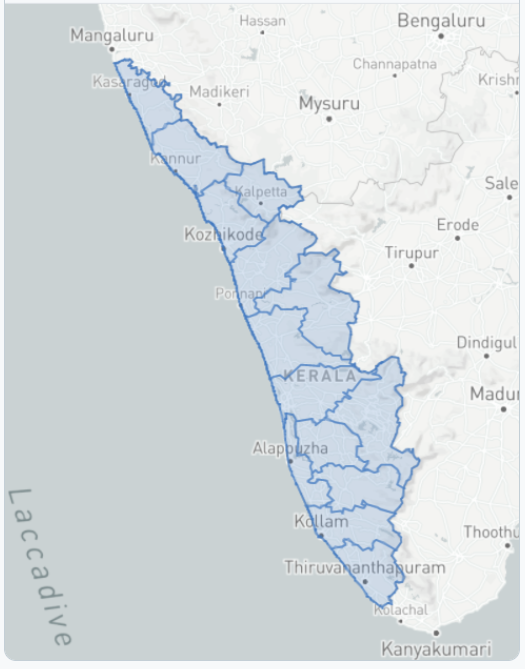
In 1998, Kuttampuzha panchayat of Idukki district was transferred to Ernakulam district as part of the district boundary reorganisation. This caused the Idukki district to lose the status of the biggest district of the state and the title was transferred to the Palakkad district. This Panchayat is the reason for the mistake. Maps with mistakes include Kuttampuzha panchayat as part of the Idukki district and make the Ernakulam district smaller. So ideally the Ernakulam district’s boundary now extends to the eastern border of the state and share the boundary with Tamilnadu.
Pre-campaign
- The Hindu - English daily
After I pointed out the mistake they corrected the map on the very next day’s newspaper and this swift action is truly appreciable.
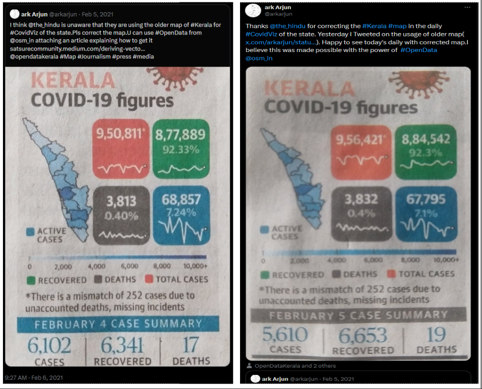
- Datawapper - Data visualisation platform
Commenting on my above tweet, Naveen Francis pointed out that The Hindu make use of the data visualisation platform Datawapper and that could be the source of error. The Datawrapper team showed no hesitation in correcting the data, the process was faster.
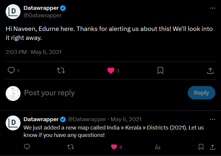
We consider that we could stop the Domino Effect by correcting the Datawrapper repo, since that is the source for many visualisations.
Campaign
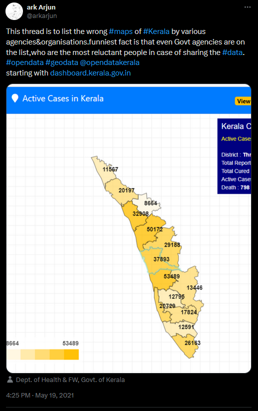
State Government Owned Sources
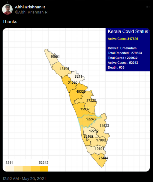
- COVID19 Dashboard by Kerala Government
The campaign thread was started with C-Dit maintained Kerala Government’s covid Dashboard.
- Chief Minister’s Complaint Cell
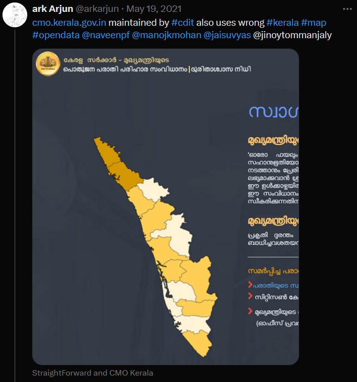
Second one on the series was another C-Dit maintained websitecmo.kerala.gov.in.
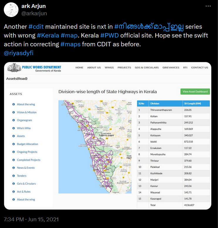
- PWD Department
Map in the Public Works Department’s official website shows a wrong map of Kerala to visualise the division wise roads
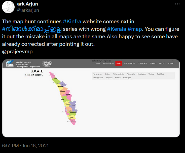
- KINFRA
Kerala Industrial Infrastructure Development Corporation holds the wrong map in their website’s park page
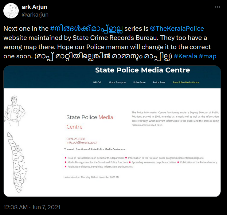
- Kerala Police
Though the map in Kerala police website is used as a symbolic graphic image and don’t indent to convey or visualise any data, both map and angle of representation are wrong. You cannot simply turn around maps and put them at any angle.
Central Government Owned Sources
- India Meteorological Department
The Twitter handle of the India Meteorological Department(@Indiametdept) is constantly posting Districtwise and Stationwise nowcast data in the wrong map of Kerala. Their official website also holds the same wrong data.
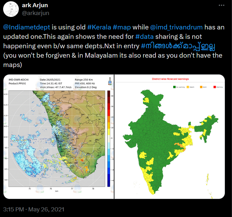
While their Meteorological Centre at Thiruvananthapuram posting from the Twitter handle posts the daily alters and updates on the right map. Surprisingly after the above tweet, I noticed that the Thiruvananthapuram centre Tweets with three varieties of Kerala maps. All three having rendered the Ernakulam District in three ways
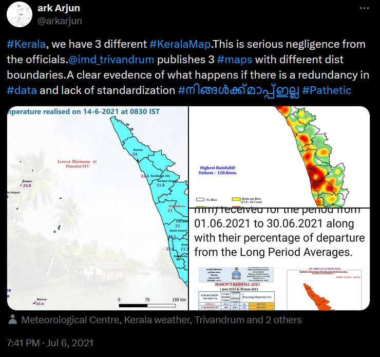
This is serious negligence and nothing else. Surely deserves action on the concerned person and the department head.
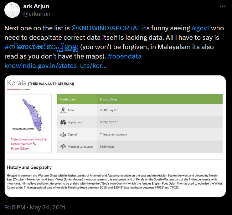
- Know India
Don’t you see the irony in the name of the website? I don’t know how many people will be visiting this website. But the map published there on the Kerala page is the wrong one.
State Election Commision of Kerala
The permanent and independent body that ensures free and fair elections in the country published wrong maps of Kerala. It was quite a surprise to me that the authenticate source of maps we often refer to, itself publishing the wrong maps.
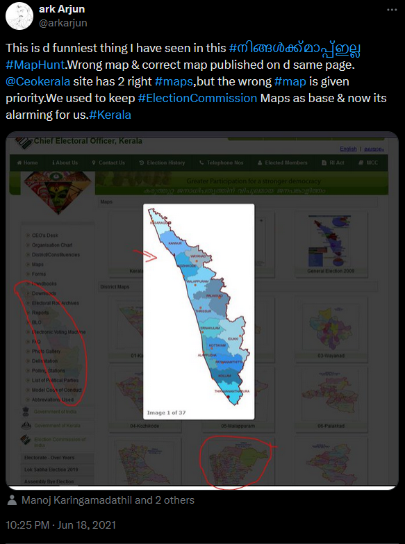
The funniest fact is that the commission’s website has given the correct map of the particular district while the state map with the district boundaries is wrong. It was also found that there was another state map in the infographics with correct representation.
Media
- Twenty Four News
The Malayalam news channel twenty four news will always stand out from other channels with their technological advancements bringing in the Augmented Reality, tele-transporting technologies first time in the Malayalam media. In the competition to present the news in the most appealing way to its viewers on the day in which new ministers of the state was declared they came up with AR graphics. The augmented reality was not the reality as per the map data.

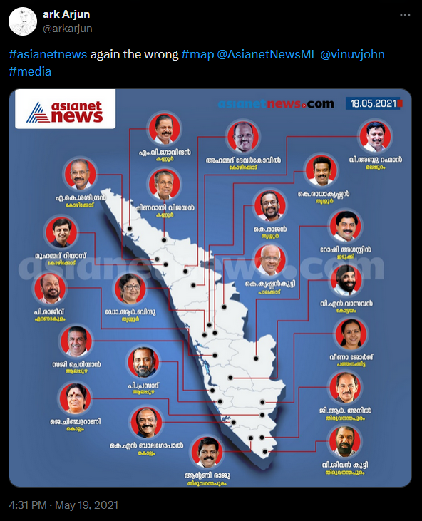
- Asianet News
One of the oldest news channels of Malayalam, Asianet News on the same day failed to present the map correctly to its viewers. The same district wise minister’s names where represented on the wrong map of Kerala.
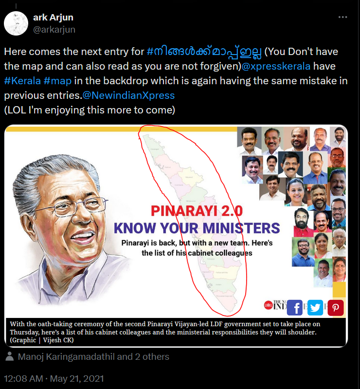
- The New Indian Express
The English daily used the wrong Kerala map in infographics they published on their website.
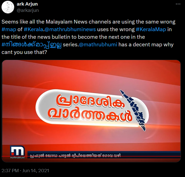
- Mathrubhumi News Channel
Mathrubhumi News channel, owned by the mainstream Malayalam print house, who also publishes the second most widely read newspaper daily in Kerala in the same name uses the wrong map of Kerala in the title graphics of one of their news segment.
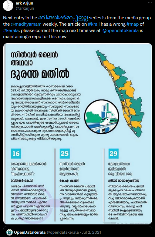
- Madhyamam Weekly
Madhyamam Weekly one of the popular Malayalam cultural magazines published by the same media house that had published India’s first international newspaper failed to print the correct map of Kerala in an article about the Krail project in their July 12 edition
The Impact
C-Dit officials corrected the Map in the COVID dashboard the very next day itself. They also corrected the CMO website was also corrected in the coming day.
Doing our part
It is unfortunate to see the negligence and complete lack of initiative from concerned authorities and various governments in maintaining updated, accurate maps of their respective states properly. But the community’s desire and enthusiasm to meet their own cartographic needs is not easily destroyed. We at Open Data Kerala were forced to package the district maps of Kerala under Open Database License (ODbL) which are retrieved from OpenStreepMap now available for the public to download for free all seeing these.
Open Data Kerala is also maintaining the repo for Local Self Government Body(LSGD) boundaries of Kerala and OpenStreetMap Kerala community is busy in making ward level map layers, expected to be completed soon.
The Endnote
The current ambiguity in map data is due to the following reasons ** Lack of updation ** Lack of data sharing ** Improper storage ** Redundancy in multiple repository ** Improper dissemination of information
Even after having an Open Data policy both by the central and state governments, it is not executed to its fullest potential. This ambiguity in map data is purely a case of a lack of proper execution of open data policy. The period which considered map data as classified data is no more applicable to the current era, where maps have become an inevitable tool for requirements ranging from complex scientific problems to daily life solutions like food delivery. The official government procedures currently being followed were created as per policies and laws that were made before technological advancements happened. Policies need to be revised to best address the current situation as well as accommodating room for the foreseeable future.
I won’t stop here. The thread will be discontinued, but will continue posting the maps in the Hashtag #നിങ്ങൾക്ക്മാപ്പ്ഇല്ല. I also request every one of you start posting the wrong maps and let the people be notified.
Any Comments on the article? Let me know @arkarjun.
(Article updated on 03Aug2024 for broken links are replaced and screenshots for each tweet were added)