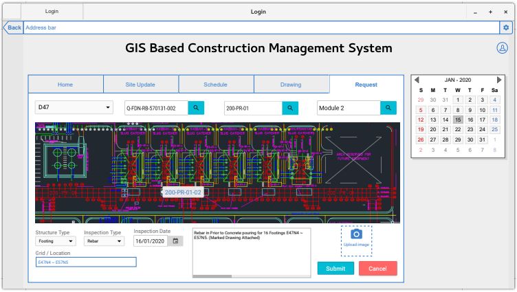
GIS Based Project Management System
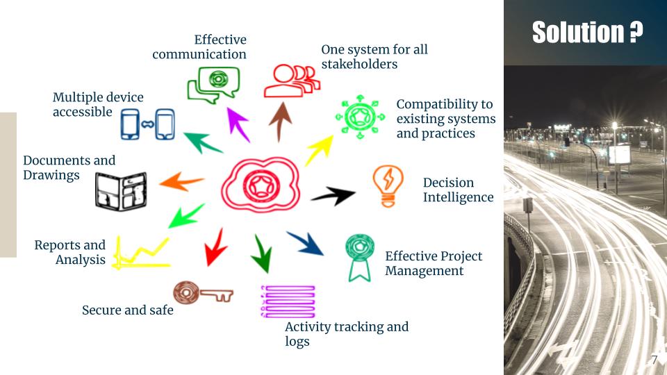
The proposed application is an all in one solution for all the problems in construction industry. A web based system with the spatial aspects, both GIS and satellite remote sensing indulged with big data analytics takes the proposed project management system to the next level not just a project management but a complete software package for the construction industry covering the entire aspect of their business.
Why I did the project?
I conceptualised the project from my hardships and experiences during my days in Saudi Arabia as a site engineer. Thoughts were running in my mind to find a solution to the operational problems in the construction industry especially in a large scale one. The civil engineering experiences and geospatial knowledge helped me to bring out a solution for most of the issues in the construction project management.
Tech
| Language | Python, Javascript |
| Framework | Geo-Django |
| Database | Postgres with PostGIS |
| Wireframing | Pencil |
Timeline
Published:June 2020
Status: Archived