The Mapping Evolution in My Life
Published: 1 June, 2024
5 mins(s) read
Tags: #OpenStreetMap #Technology
Series: Mapping for Tomorrow: Building Resilience through OpenStreetMap Contributions
Posts from "Mapping for Tomorrow: Building Resilience Through OpenStreetMap Contributions" series:
Table of contents:
Why are you contributing to OpenStreetMap? How did you end up in OpenStreetMap? Why should someone contribute to OpenStreetMap? etc. are some of the many questions I used to get when talking about OpenStreetMap. This blog is a deep dive into my journey with OSM, highlighting its transformative impact on my life, career, and the broader mapping landscape. As you know I can talk endlessly about OpenStreetMap putting it as a blog series
License: This article is licensed under the Creative Commons Attribution-ShareAlike 4.0 International (CC BY-SA 4.0) license.
Start of the Journey
My interest in open-source and free software began during my school days (2008 summer vacation to be precise) when Kerala Government-led programmes such as IT @ School (now KITE) adopted the Free and Open Source Software (FOSS) in schools. My interest in Open data and open knowledge started when I wrote articles on Wikipedia back in 2008. It was the same time Swathanthra Malayalam Computing meet-up happened in my town, I was introduced to the world of Localisation (translation to local language) projects of multiple FOSS projects like Mozilla, Loomio etc. The initial motivation was to see my name in the contributor lists of the software releases. I still remember translating the Loomio project into Malayalam in just a day. Slowly I understood the FOSS philosophies and that became my motivation for contributing, and this continued in my life.
The Discovery
The turning point came during my engineering college days(2012) working on a project that necessitated access to local Panchayath’s map, I faced significant challenges in obtaining accurate and accessible maps through traditional channels. I knocked at the Panchayath office, Block office, Village office and every other possible office door for the map. This frustration led me on a quest that ultimately brought me to OpenStreetMap, a platform that not only provided the map data but also ignited my fascination with mapping technologies and the power of community-driven initiatives. It was through one social media post of Jaisen Nedumpala I got to know about OpenStreetMap. Recollecting the challenges faced during the map search led to my realization of the importance of projects like OSM and the significance of open data.
I attended my first OSM mapping event Koorachundu Mapping Party organized by Jaisen Nedumpala in 2014, where you I was the second trainer. We 22 volunteers mapped the ward boundaries and public assets of Koorachundu, marking Kerala’s first mapping event which was not part of a FOSS event, and the first mapping event hosted by a government agency in entire India.
Behind the scenes from Koorachundu Mapping Party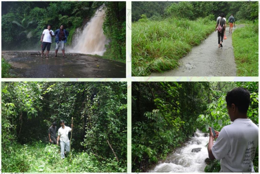
Awesome OSM
OpenStreetMap (OSM) represents more than just a mapping platform; it embodies the principles of open data, community collaboration, and accessibility. Unlike proprietary mapping services, OSM offers freedom and transparency, allowing individuals to contribute, edit, and access map data without restrictions. This open approach not only fosters innovation but also ensures the accuracy and relevance of map information. Driven by a passionate worldwide community dedicated to open data and accessible geospatial information, OpenStreetMap (OSM) shines as a light of collaborative mapping in the dynamic world of digital cartography.
Why OSM?
The Tech
I am not focussing here much on the tech utility of OSM as one can read from many other resources how OSM provides a wealth of geospatial data that is freely available for anyone to use and contribute to. This data includes information about roads, buildings, landmarks, transportation networks, etc. From a technical standpoint, OSM serves as a valuable resource for a wide range of applications, including:
- Navigation and routing services
- Geographic information systems (GIS)
- Urban planning and infrastructure development
- Disaster response and emergency management
- Environmental conservation and analysis
The open and collaborative nature of OSM allows developers, researchers, and organisations to access high-qual ity geographic data for various projects and initiatives.
The Philosophy
Beyond its technical utility, OSM includes significant philosophical principles related to open data, community collaboration, and democratizing access to information. The vision of Steve Coast, the founder of OSM was
The world’s most up-to-date, complete and universal map. Oh, and FREE.
Thus OSM operates under the ethos of “open data for the world” and promotes the following key principles:
1. Freedom of Information: OSM advocates for the free and open exchange of geographic data, empowering individuals and communities with access to accurate and up-to-date maps. Proprietary mapping companies often prioritize areas of business interest, leaving remote and less economically viable regions unmapped in most parts of the world.
2. Community Collaboration: The strength of OSM lies in its diverse community of contributors who work together to improve and enrich the map data. This collaborative approach fosters innovation and inclusivity, ensuring that errors are minimized and data quality is maintained.
3. Data Ownership: OSM emphasizes the ownership of data by the community, ensuring that contributors retain control over their contributions and that the data remains freely accessible to all. In contrast, proprietary maps may contain purposefully added errors or suggest features based on business interests rather than the user’s needs.
In essence, OpenStreetMap represents not just a mapping project, but a global movement towards democratizing geographic information and promoting transparency, accessibility, and collaboration. Hence in today’s world Why OSM can be summarised into three quotes below
Control
“Who controls the past controls the future. Who controls the present controls the past.”
– George Orwell, 1984
Who controls the map, controls the future
Equality
“All animals are equal, but some animals are more equal than others”
–George Orwell, Animal Farm
All map data is equal in OSM
Power
“Information is power. But like all power, there are those who want to keep it for themselves”
– Aaron Swartz, GOAM
Location information is powerful
Will be writing about the following in next part
- Motivation for Contributing to OSM.
- Some OSM Impact Stories
- Growth with OpenStreetMap (OSM)
- Getting Started with OSM
Let me know your suggestions on the topics for the next part and post your thoughts @arkarjun. Stay tuned for the second part.