There is a Bend on Mullaperiyar Dam? Is Google Map True?
Published: 6 August, 2024
5 mins(s) read
Series: Mullaperiyar Dam: Fearmongers and Scientific Temperament
Posts from "Mullaperiyar Dam: Fearmongers and Scientific Temperament" series:
Table of contents:
Through this article I try to explain the technical glitch that happened with Google Maps over Mullaperiyar Dam. Which was used as an unscientific reference to prove the dam is unsafe. My intention is only to educate the society on google map aspect and not support any other views.
License: This article is licensed under the Creative Commons Attribution-ShareAlike 4.0 International (CC BY-SA 4.0) license.
Preface
I came across a trending video where a person (mentioned as an advocate) explained the weakness of the dam “Scientifically” (please understand the sarcasm). The person interviewed by a YouTube channel on the safety of Mullaperiyar Dam explained why the dam needs to be decommissioned and its impact if it breaks. The controversy over the safety of the dam and court cases between Kerala and Tamil Nadu is well known. And the issues have many sides of interpretations as well, so what’s the issue in it, isn’t that your thought right now? The issue is, when I listened to the video the way the person talks and the things he narrates scientifically(which he thinks scientific) I found a little indigestive.
I am neither a dam safety expert nor someone who can vouch for the competency of that person. Expert studies are available from IITs and other institutions who studied the matter. I am also not neither demanding the dam be decommissioned or retained, let the experts decide.
All I am afraid of is that his points can only panic people, especially in this time of the Wayanad issue. With all the knowledge I have as a Civil engineer and a practising geospatial professional, I found lots of logical problems and blunders in the person’s speech.
There is a Proverb in Malayalam “മുറിവൈദ്യൻ ആളെക്കൊല്ലും” means “A pseudo doctor can kill a person” or translates simply to “a quack doctor is worse than a dagger.” I recall my college days in 2011 at Coimbatore, the atrocities and hatred which caused nothing but chaos and loss of peace among both communities after a court verdict and fake news spread around it.
Google is not Bible
Google Maps or Google Earth is a software package or mapping platform which uses geospatial data and algorithms to render maps and other earth-related features on a mobile app or a webpage. Like all software, it can also go wrong and have limitations. There are petabytes of data from multiple sources being processed through various algorithms at multiple time stamps by different machines to render the map you see on your screen. Read my previous articles on Google artefacts caused news attention for knowing some of the old such instances
- The Mysterious Island is no more mysterious!
- Answering the unanswered; Answers to unanswered questions of the mysterious Kochi island
- Google Maps, The Odiyan of Kochi!
Bend in Dam Structure?
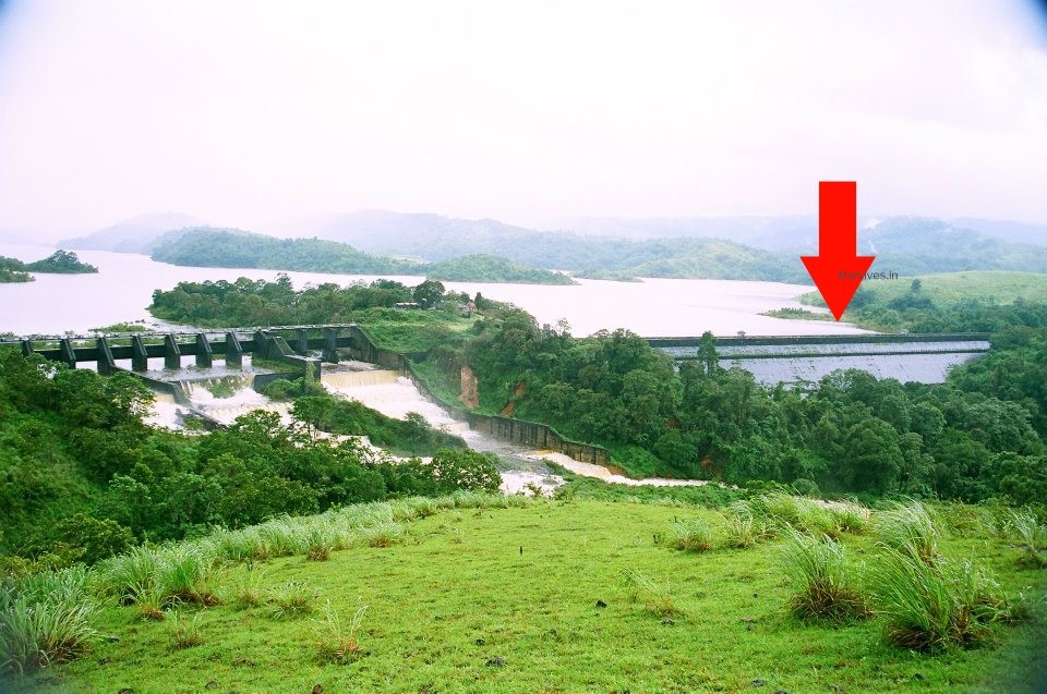
The person says(or when the anchor points it) that there is a bend Mullaperiyar dam structure it was not visible in the 2020 image but it is visible now and to the flow he adds if the dam itself will not exist in the coming years. He confidently says this cannot be a processing issue from Google Maps as it is a big structure that can be visible.
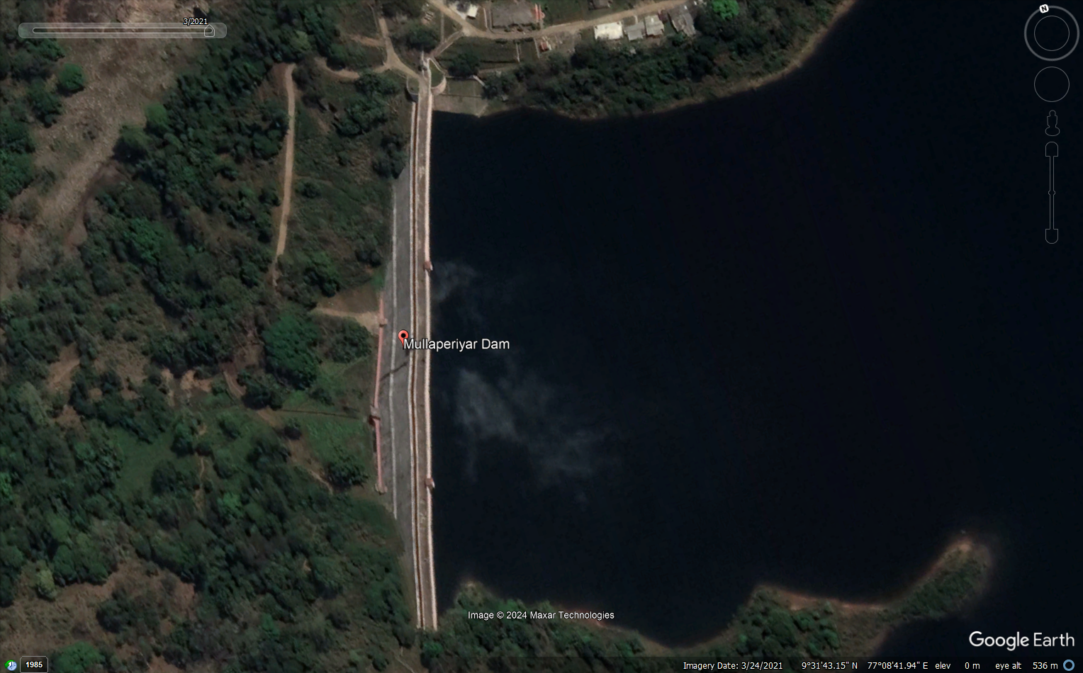
Is there a bend in the Mullaperiyar Dam?
Absolutely, NO! (or at least not to the level it is visible in a satellite image)
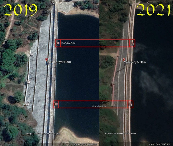
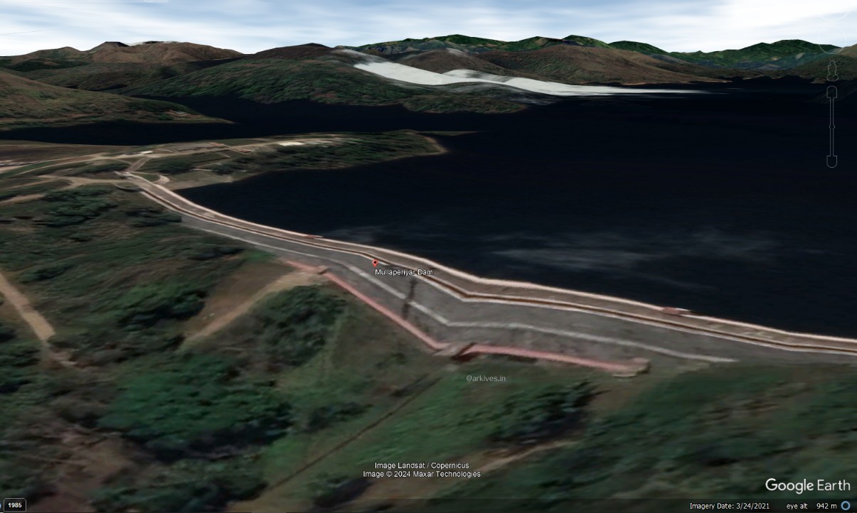
What is the Truth?
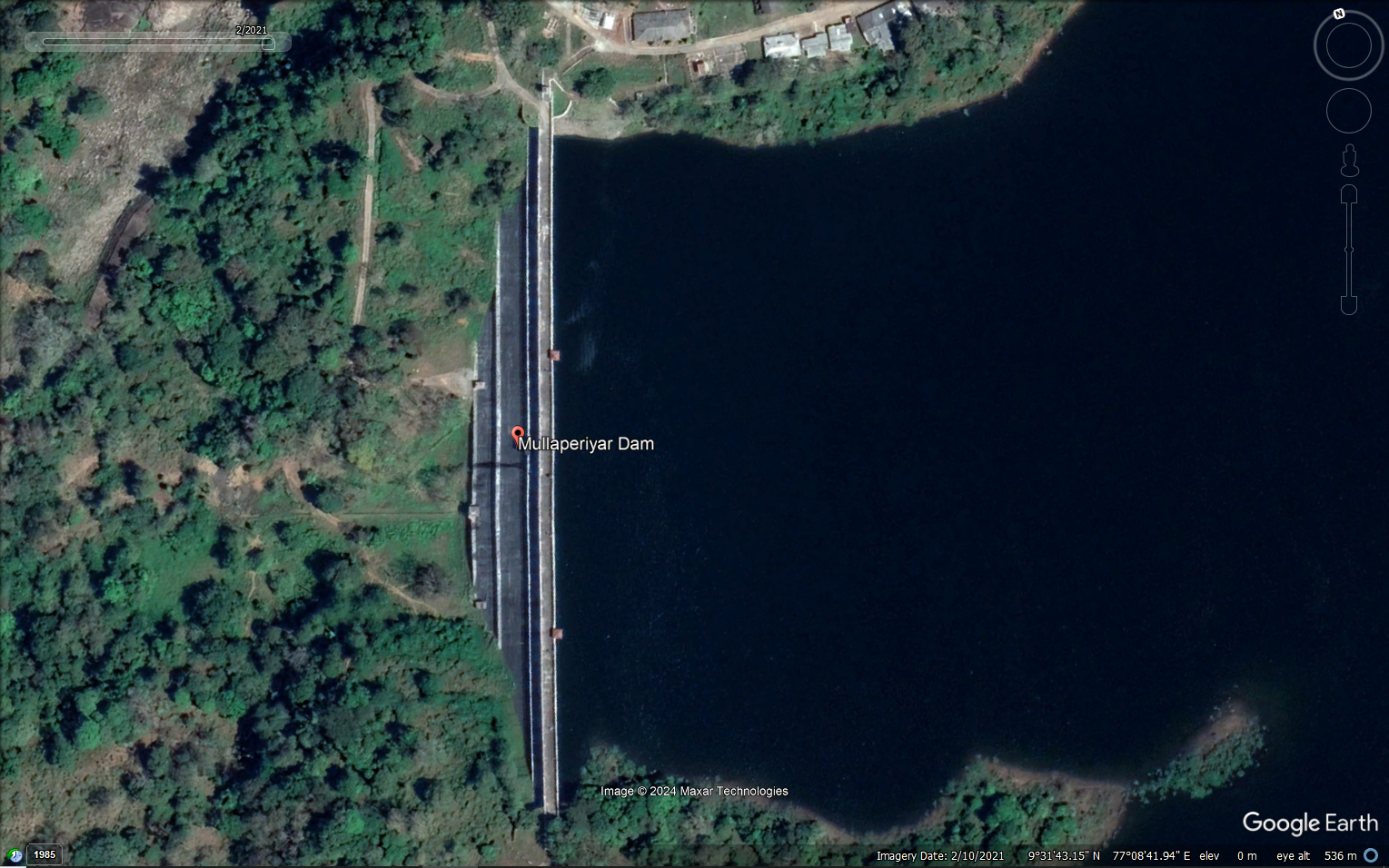
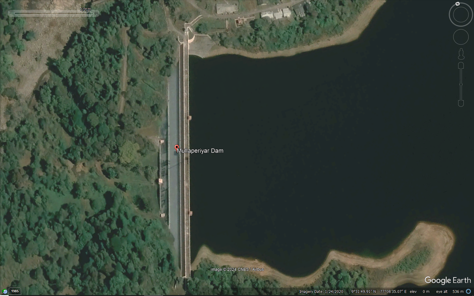
The below images prove that there is no bend as shown in above image.
What has gone wrong?
The terrain and look angle of the image created this artefact. The dip in the terrain at that point and look angle of the satellite created a slight distortion. Which can be seen in the marked point in the image below. The terrain’s depression distorted the image while ortho-rectifying the image (putting the image in a way that you look exactly from 90 degrees to the ground)
Any Comments on the article? Let me know @arkarjun or @ Medium.
PS: I am delibrately not posting the links to the video of the interview and the image of the person.
[Update] Added watermark in certain images on 08 Aug 2024 due to excessive usage of those images without permission.
Will Mullaperiyar Dam Break? Some Engineering Truths, a follow up blog to this article was published on 18 Aug 2024.