Google Maps, The Odiyan of Kochi!
Table of contents:
Through this article I try to explain the technical glich happened with Google Maps over International Airport of Kochi.
License: This article is licensed under the Creative Commons Attribution-ShareAlike 4.0 International (CC BY-SA 4.0) license.
Preface
In last June (2021), there rose a mysterious island in Kochi. No No No..this is not a fantasy story I am going to narrate, the artefact island made in Google maps later known as “Payarumani Island” is what I was mentioning. I wrote a blog post on it — The Mysterious Island is no more mysterious! and a follow-up blog answering many other questions raised after that blog — Answering the unanswered. Both blogs were intended to educate common people about satellite imaging and not to get deceived. Happy to see the impact, at least people started thinking. Recently I saw a news report by Manorama News explaining the errors in Google maps at Cochin International Airport. I think the “Payarumani Island” incident had an effect, the media tried to investigate and properly report it. It also recaps the old island issue twice in the report. So I thought of explaining a bit more from the report and how this might have happened.
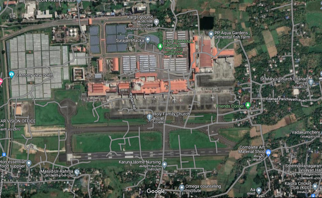
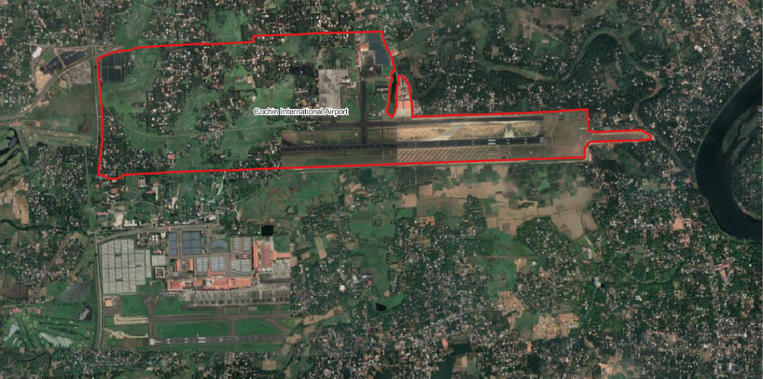
The report [Watch(in Malayalam)] says that google maps show five worship places and other buildings on top of the runway of Cochin International Airport(CIAL). The report further explains it is an error which happened while stitching the images from google. The report also says that the error is only with the satellite view and not in the normal map view.
Before explaining the issue, let us see some basics
Generally there are two geospatial data types Vector and Raster. Rasters are images which are made up of pixels(the small squares which you see when over-zooming an image). Vectors are the lines, points and polygons which are used to represent the features on the maps. Unlike rasters, vectors can be enlarged any number of times without breaking or pixelating. The satellite images are stored as georeferenced images in raster format while the roads and places are stored as vectors. Technically they both have no interdependency unless they are spatially overlaying on each other.
What had gone wrong?
The satellite map layer, also called a satellite base map, is created by stitching various images from different satellites of different time periods and choosing the best images of the region. Once the best scenes for each area are identified they are stitched together and rendered as a Web Map Tile (WMTS) layer. These tile layers load very fast and require very less data consumption compared to loading each image one by one. The Vector layers are also not directly loaded into the web map applications such as Google Maps they are also Tiled or served as Web Map Service (WMS). So basically when you load an area with satellite view, what happens at the backend is two layers are called and displayed one on top of another this is also called an overlay.
So how are these two layers coinciding exactly with each other? This is achieved using the process of georeferencing. When a satellite captures images it is not georeferenced. The image is geographically referenced with the help of a lot of Ground Control Points (GCPs) whose locations (latitude and longitude) are already precisely determined. Georeferencing can be explained in simple terms as the perfectly aligning an image with respect to the ground features.
If you see the map layer you can see all the airport roads, places, airport buildings etc. are a little above the runway scene seen in the satellite view. This is because the issue had happened only with that particular satellite scene and not to the vector layer. This might have occurred due to the georeferencing errors that happened while processing the images. On further panning down the map to the south of the actual airport (panning north to the area having issue), we can see another half of the runway and airport facilities. Even if you use the timelapse feature of google earth, the georeferencing error is visible.
Does this happen to all the upcoming satellite images?
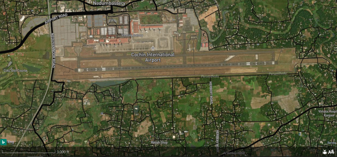
No! This is only a problem that happened while processing that particular scene. The georeferencing error may not have happened from google’s side, or maybe the image provider might have given the image with a shift, only Google can confirm this. Some other satellite images of the same area are shown below for understanding.

Before I conclude let me correct Manorama News on a small terminological mistake, that Google Maps is not a Navigation System. It is just an application which helps you with Navigation and many other facilities. A Navigation System is a system which aids you in navigation by computing the position and heading. Google Maps is an application which uses satellite positioning principles, the internet and various other algorithms along with the ocean of geospatial data to enable navigation from one point to another.
PS: The Odiyan is a clan, who in Kerala folklore are men believed to possess shapeshifting abilities and can assume animal forms. Odiyans are said to have inhabited the Malabar region of Kerala before the widespread use of electricity.
Any Comments on the article? Let me know @arkarjun or @Medium.