From Passion to Habit: Routes to Daily Mapping
Published: 9 August, 2025
7 mins(s) read
Tags: #OpenStreetMap #Technology
Series: Mapping for Tomorrow: Building Resilience through OpenStreetMap Contributions
Posts from "Mapping for Tomorrow: Building Resilience Through OpenStreetMap Contributions" series:
Table of contents:
In the last two parts of the series Mapping for Tomorrow: Building Resilience through OpenStreetMap Contributions, we have seen Why I started mapping in OSM and What motivated me to map. In this part, I will discuss about the ways one can (or at least the ways I have done) consistently make contributions to OSM. Let’s see the How part from my perspective.
License: This article is licensed under the Creative Commons Attribution-ShareAlike 4.0 International (CC BY-SA 4.0) license.
In the first part The Mapping Evolution In My Life, I have said that I started serious contributions with a mapping party. After the Koorachundu Mapping Party, there was a big pause in the mapping apart from occasional mapping of features around my home. Mapping parties became the only way to do a large volume of contributions over a longer period. The purpose was missing, and the frequency of mapping parties were also too low. The idea of community, open data, open source contribution etc., remained as a concept or something which was ‘a good to have’ (for me then). Whenever I have time and mood, I do.
The Transition
The real transition from a hobbyistic mapper to a regular mapper started post 2018 Kerala Floods. A massive flood of centuries hit Kerala in 2018. There was water almost everywhere and data nowhere. All the so called free map services and platforms which worked online became of no use as the network was hardly available. All the landmarks were under the water, roads and streams were the same. The rescue team, volunteers and officials were working only with assumptions. Me as somebody away from the state can only imagine of coordinating things remotely like many others did(Kerala rescue is an example). I was not able to contribute much with mapping during the days of flood but was lucky to know the real pain and helplessness of people with grassroot level rescue missions participating remotely in projects like Project Lifeboat (that’s another story for a different time). That was the point I understood even with people ready to help, sometimes things won’t work.
That was the same year India hosted State of the Map Asia and got the opportunity to attend it. The small and unique mapping projects like Velur mapping and their impacts during the flood were discussed. The change that data could bring during and even after the flood was huge. Everyone from Kerala there who were remotely mapping and hardly knew each other destined and decided to work towards a common goal of building Open Geo Data. And that’s the place where OSM Kerala was reborn (Read the OSM Kerala story here). This was the same time I was selected to be one of the Tasking Managers from India in HOT Tasking manager.
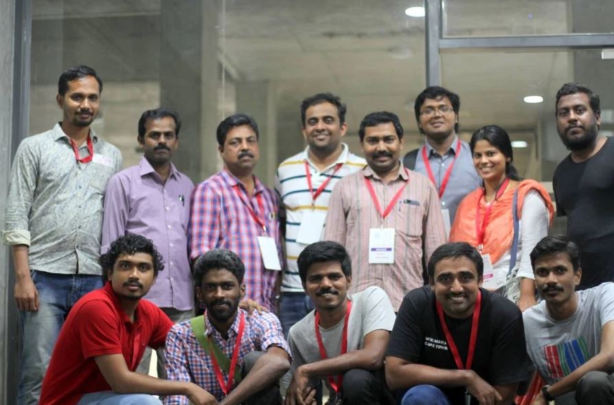
Contributors from Kerala attending State of the Map Asia 2018 in IIM Bangalore
We were even able to convince the government of the need to open Geo data and launch the Mapathon Keralam Project by the Govt of Kerala. It was a scaled up version of our Koorachundu mapping party from the canvas of a locality to the entire state. Data started flowing like the rivers during floods. Well that was not just another idiom used, like the flooded rivers carrying all mud, trees, debris and what not, the data lacked in standard, poor quality, and junks. This forced us to think about the emphasis of standardisation, quality training and validations.
The Path
HOT Tasking Manager
Tasking manager hosted by Humanitarian OpenStreetMap Team(HOT) is an open mapping tool which allows volunteers to add data to OpenStreetMap in an organised way. Communities can host projects mainly at times of disasters, and volunteers around the globe contribute by adding data and validating it. Tasking Managers are people chosen by communities and organisations to host projects and manage the mapping projects. The Area of Interest is divided into grids, and instructions are given to each task/project. Volunteers contribute according to those instructions, and validating volunteers validate it. Teach OSM is a similar Tasking Manager hosted by the OSM US community. Projects from all parts of the globe are listed in the tool, along with priorities; you can choose any and start contributing to it.
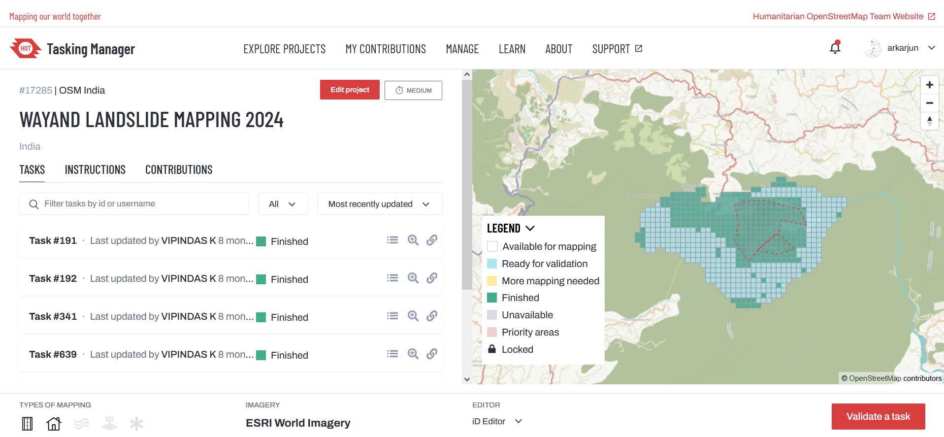
Tasks of Wayanad mapping project in Tasking Manager.
I found the purpose as motivation to do mapping using the tool since it is being used for disaster response almost in near real-time. Having the privilege to create projects in the Tasking Manager made me feel responsible, since then, Tasking Manager became one of the major tools I am using for mapping during disasters, not only for adding data but also activating the projects as and when a disaster happens or is requested from the community.
COVID - The New possibilities
COVID hit the world, and suddenly everything became still. OSM Community in India explored the new horizon, then turning the limitations to strength, we started online mapping parties, Virtual Mappy Hours, online training, quizzes, etc. The community became more active, and the community grew like anything. These increased the frequency of mapping, validation and community building.
Zoom in Map out
It was during this time that I explored tools like results map. There I could see the Heat map of contibutions very existing, I started zooming in areas where I have not contributed. Slowly, I became greedy to make a mapping presence and have colour on the entire India of my heat map and zoomed in on the empty area and mapped there for days. This was combined with a thought from my friend that mapping with a theme like water bodies, roads, canals and so on. For a longer period, I tried these two ways and contributed to OSM along with other activities.
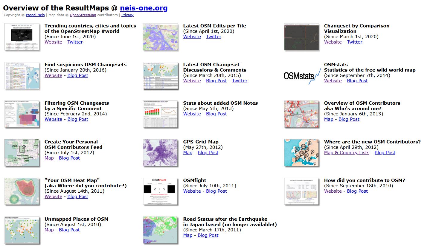
Overview of the various tools available in ResultMaps @ neis-one.org
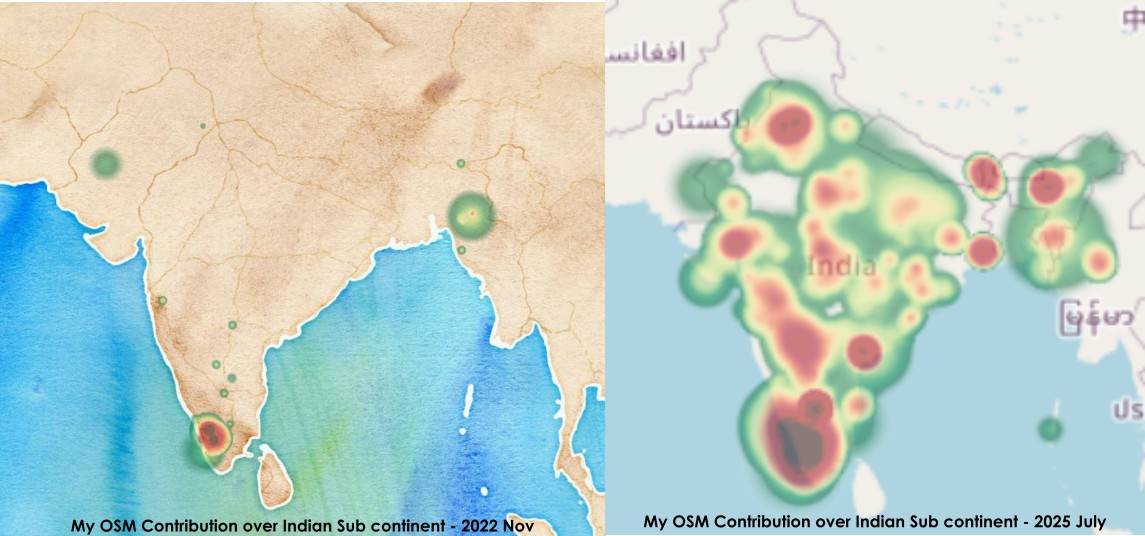
A Heat Map of my OSM contributions over India sub continent 2022 November Vs 2025 July
Field mapping and applications
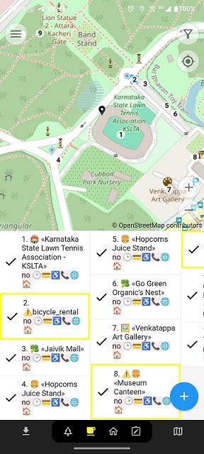
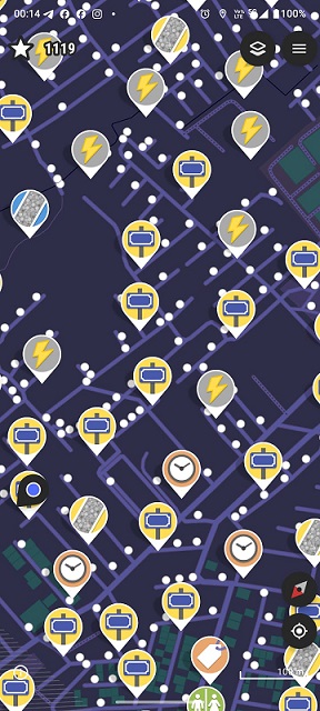
Although I had organized and facilitated many mapping parties and field mapping right from the very first mapping part till I got introduced to Every Door app I was preaching people to map from desks and not on fields, field data has to be collected and mapped from the desks. 2 Apps changed this thought process of mine - Every Door and Street Complete. These two are too good for micro-mapping and PoI mapping.
Every Door
Street Complete
The steep jump from a 35-day mapped year to 359 day mapped year in my life was only because of these two applications. Every Door focuses on adding POIs, and as the name suggests, Street Complete focuses on micro-mapping and adding finer details. When you have fewer features mapped in the locality, Ever Door will help you in adding the missing things, while Street Complete helps you add additional attribute information to the already mapped data, such as street name, house numbers, road surface, road crossing and so on. Both applications have presets allowing users to contribute with fewer taps on the phone. This is very important for a field mapper who is surveying in the field and the time is limited. These intuitive apps empower even beginners to map with details like an advanced mapper.
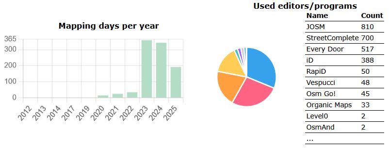
My Mapping over the years and along with tools used
OSM Guru Fellowship
I received the OSM Guru fellowship for the validation track by the Humanitarian OpenStreetMap Team in 2024. This was a great opportunity to be part of a structured training around OpenStreetMap and its tools. The fellowship helped me explore and sharpen more validation and quality control tools. OSM inspector is one of those which is now my go-to tool. Since then, I leveraged my experience and used this tool to fix as many issues as I could.
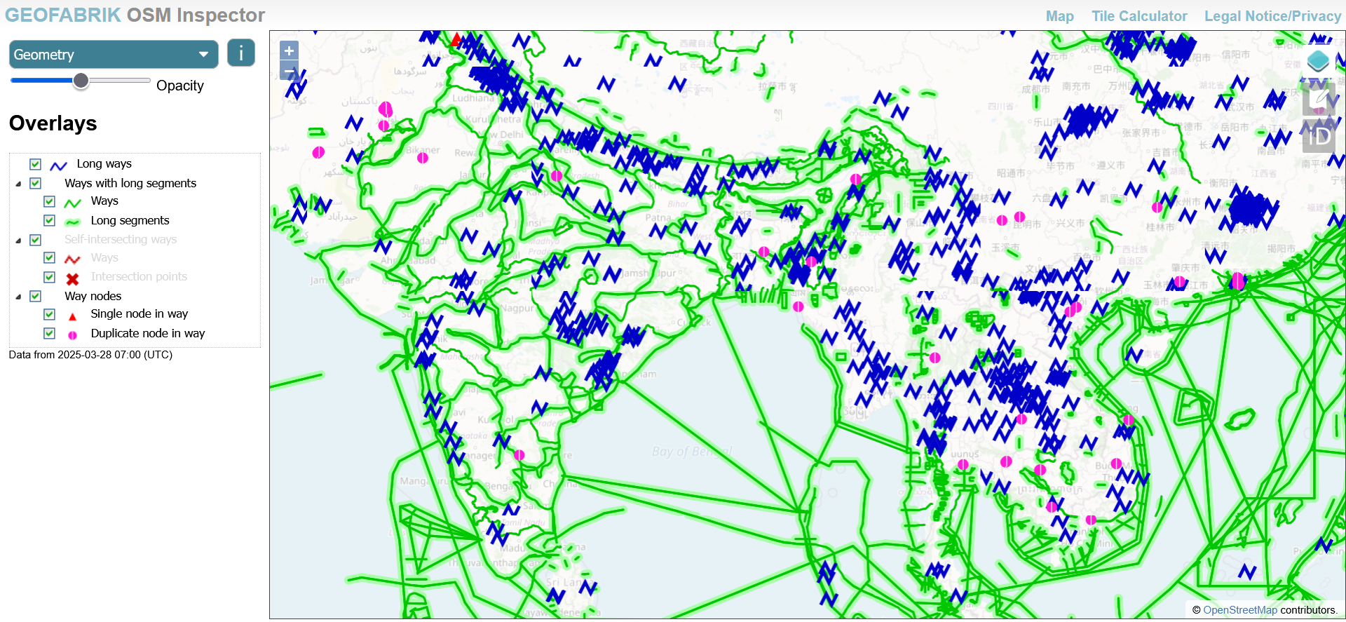
OSM Inspector Interface
My experience during the fellowship is scribbled as an OSM Diary - My Exploration as an Open Mapping Guru Fellow.
A Habitual mapper
All these small and big tools, thoughts, responsibilities, experiences, and knowledge transformed me from a Passionate Mapper to a Habitual Mapper. I use Street Complete to add micro mapping information, use Every door to add POI, Tasking Manager for disaster response focused mapping, OSM Tracker or OSMAnd add the GPS traces, Organic maps to Navigate, OSM Inspector for finding quality issues, the default ID editor for quick corrections/edits on features and JOSM for bigger feature level edits. With mapping 340+ days in two consecutive years and targeting the same for this third year, it was possible only because, unknowingly, I had become someone who couldn’t sleep if I didn’t map at least a small feature that day. Thus, a Habitual Mapper was Born!
Since this section is already longer, I not mentioning the professional opportunities related to OSM in this part.
Let me know your suggestions on any other topics you think I should cover in the next part and also your thoughts and feedback @arkarjun.